
Shoulder season adventures in Banff & Canmore: a low-impact guide
And by “low-impact”, I mean the environment and your body.
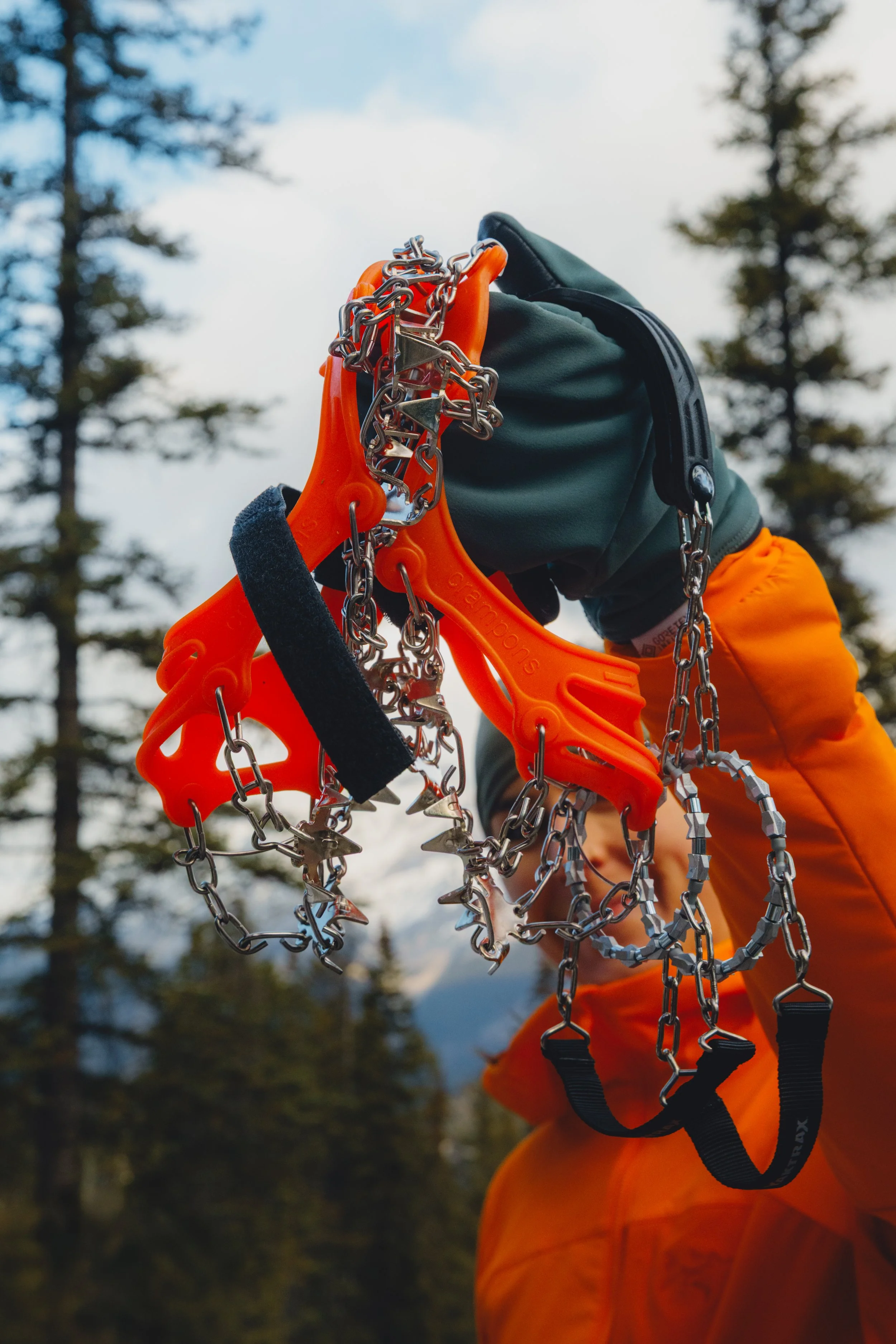
Because no one wants to be that person falling on an icy trail without their microspikes 😉
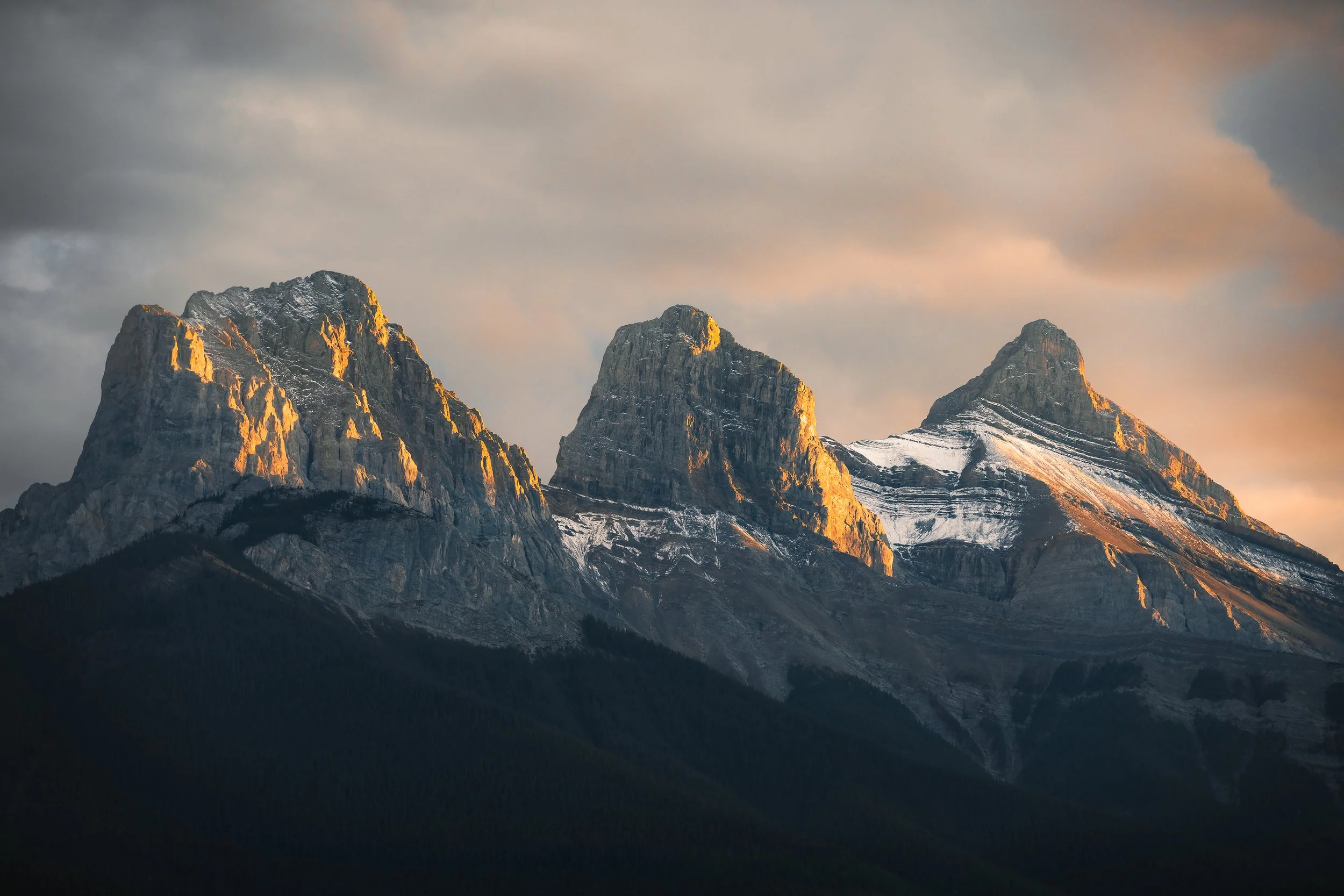
"Light of Day” by Alex Mackenzie. Sunset views of the stunning Three Sisters in Canmore, Alberta.
Quick note before we get into it: a version of this post was originally written for the team at the Coast Canmore Hotel, where I had the pleasure of staying in November right after the Banff Mountain Film & Book Festival. I had such a beautiful stay with them, and you’ll note through this guide even more reasons why they’re the ideal base camp for your Rockies adventures.
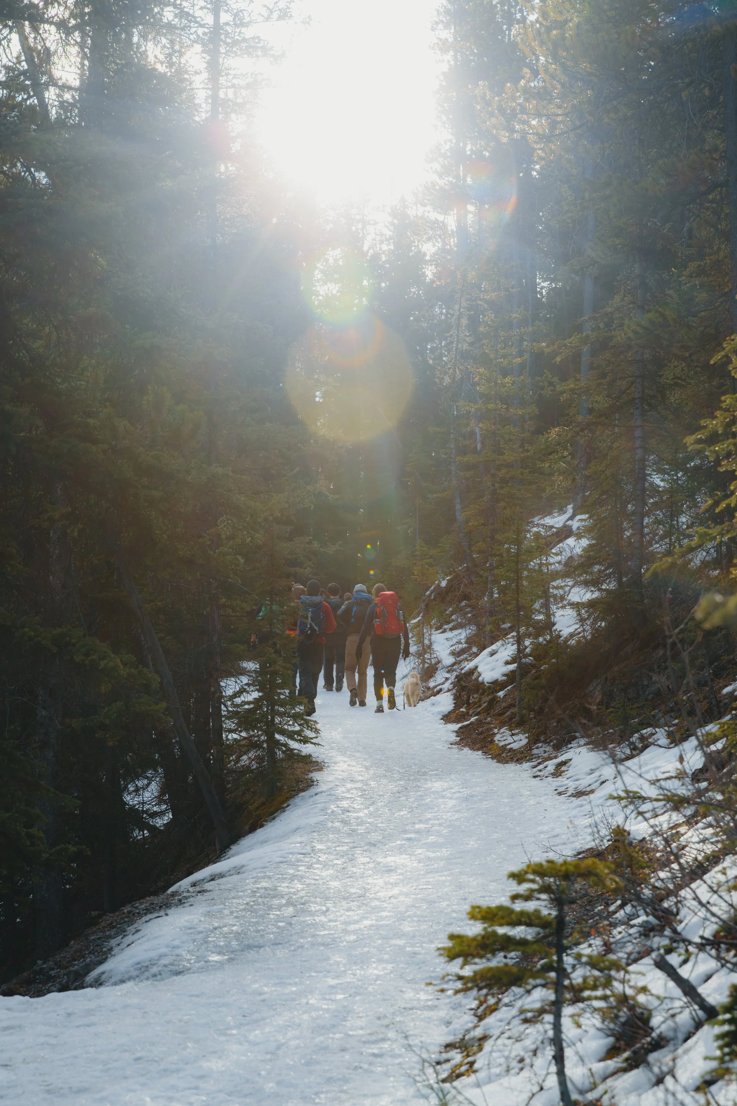
So there I was, hiking up the trail on a crisp October morning: one of those days where the valley shone bright with dustings of snow on the ridge. Blue skies and crisp fall air in my lungs.
But I was feeling stressed. I was on a fairly popular local trail that leads up to a gondola. Yet, for every five people I passed, maybe one was adequately prepared with some form of microspikes. It was incredibly slippery and only got worse higher up due to recent freeze-thaw cycles. I helped at least three groups across sections of trail because they couldn't move without slipping. Many also didn’t realize the gondola was closed that day, so everyone had to come back down the same way they came up.
These folks weren't reckless by any means, they just didn't know what the trail was going to look like once they started gaining elevation. Fall in the Rockies has its own specific set of variables, and once you know what they are, they're genuinely easy to prepare for. What follows is what I actually talk about on guided days when the seasons are changing, plus a few notes about getting sustainably exploring the region that I wish someone had told me earlier.
What the trails actually look like when temperatures drop
A key element that catches many visitors off guard: conditions at the trailhead have almost nothing to do with conditions higher up.
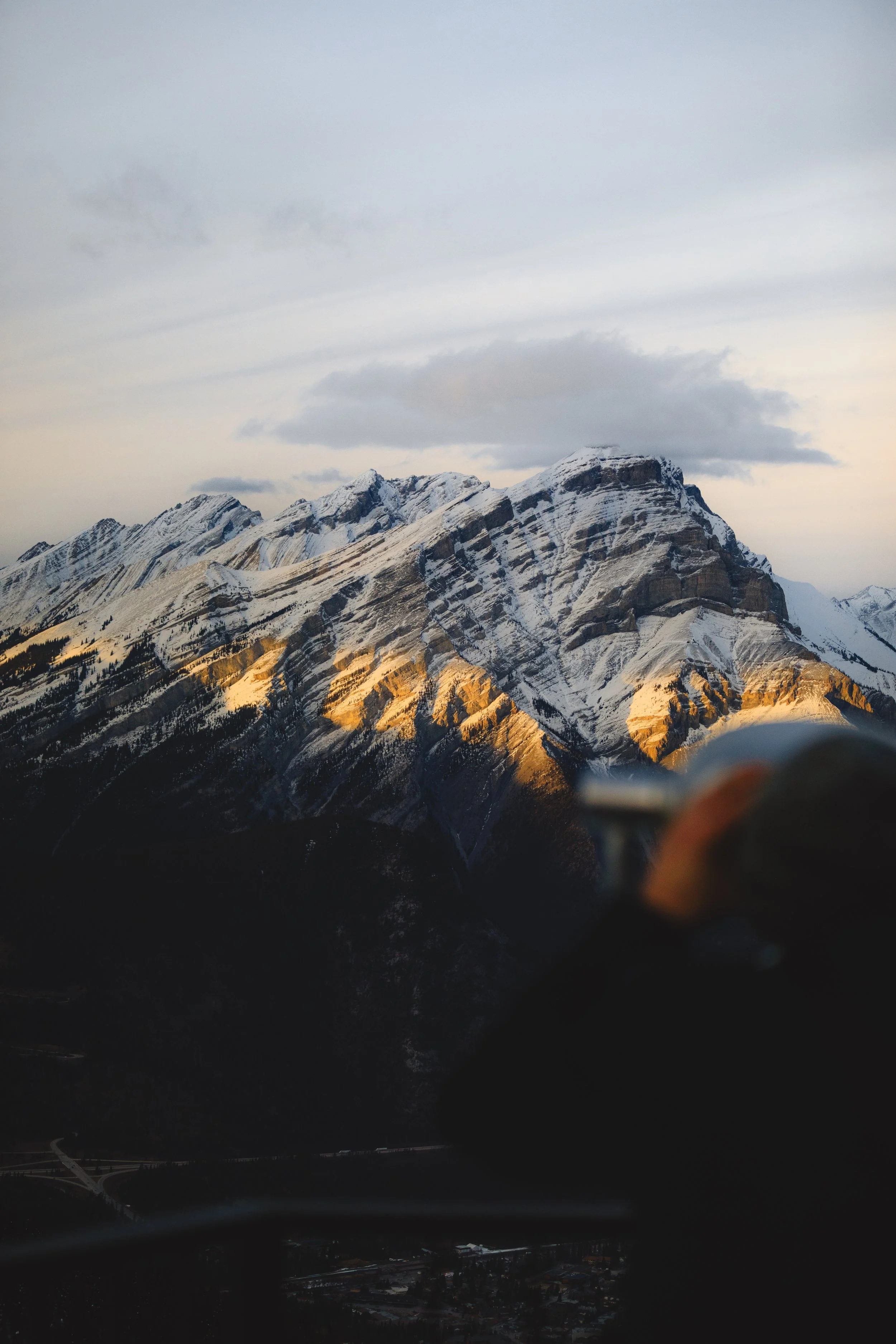
That morning at the trailhead there was very minimal signs of snow or ice. The lower switchbacks had been dry all morning, and you couldn’t see any risks specifically from the base (unless of course you looked at the surrounding mountains). But what can easily go overlooked is that with higher elevations in the upper sections the temperate progressively drops, plus you get more wind as you move toward the alpine. That's a specific trap of shoulder season: the weather app said 3°C and sunny, and technically it wasn't wrong. It just wasn't the whole story.
Shoulder season in the Rockies runs on freeze-thaw cycles: in a given day the trail can be soft and grippy at 7am, icy by 9am in the shadier sections, slush by noon, refrozen by late afternoon. The trail you hiked up is not always the trail you'll come down on. On different days, you could have very different conditions: early in a week you may have had tons of soft sticky snow, followed by some warming and rain, followed by a cooler front that comes in a freezes the remaining slick ground snow.
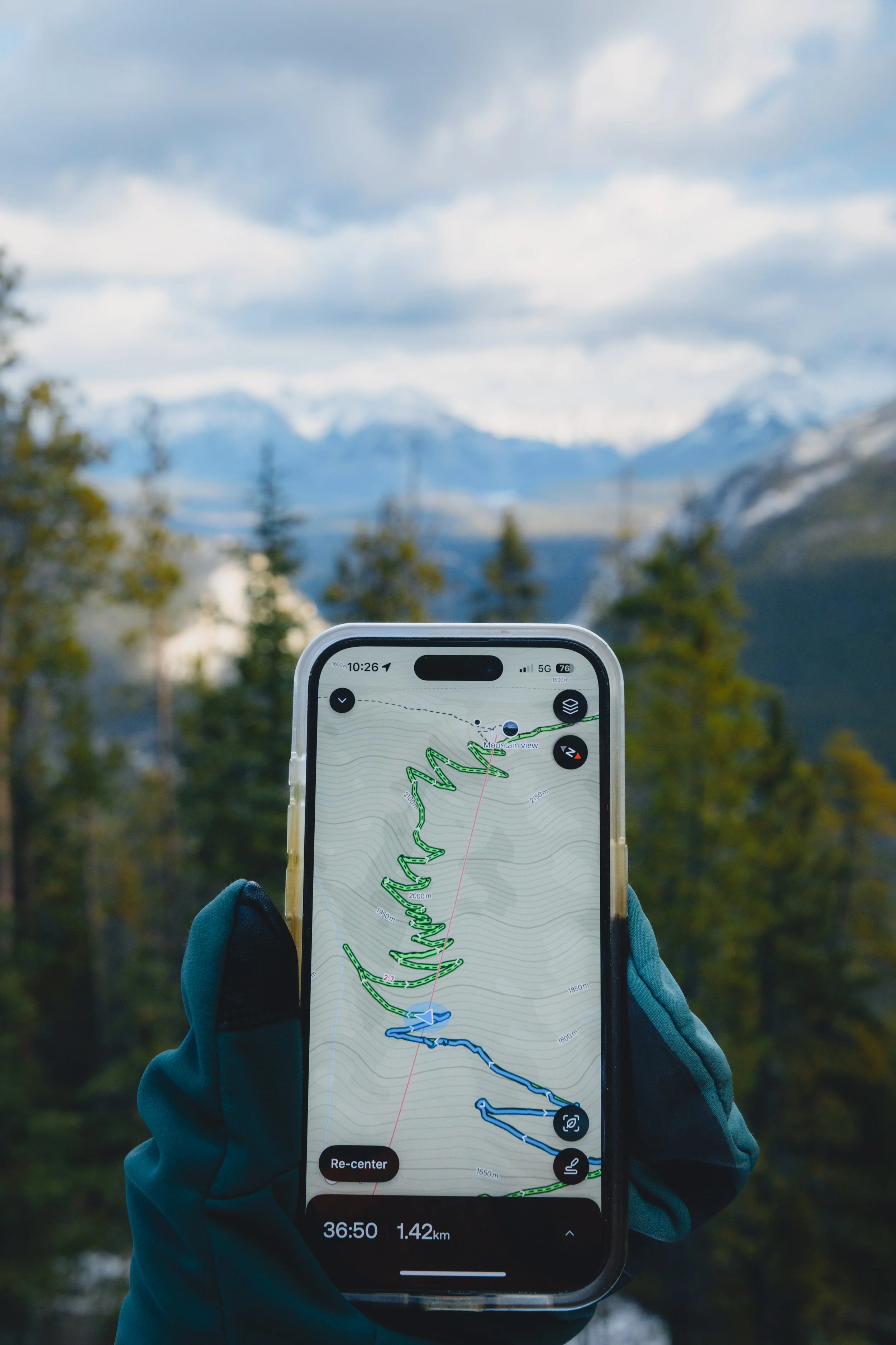
Here’s the good news: ten minutes of research the night before can entirely help you avoid suprises on the trail. Parks Canada updates Banff conditions and closures regularly, and AllTrails has recent user reviews that often catch conditions faster than official sources. And if you like getting a little more nerdy, SpotWX is worth bookmarking for high-resolution forecasts at elevation rather than just the valley floor. Remember, you're not trying to predict the weather perfectly, you're simply trying to not be surprised by it.
How to pack like a pro
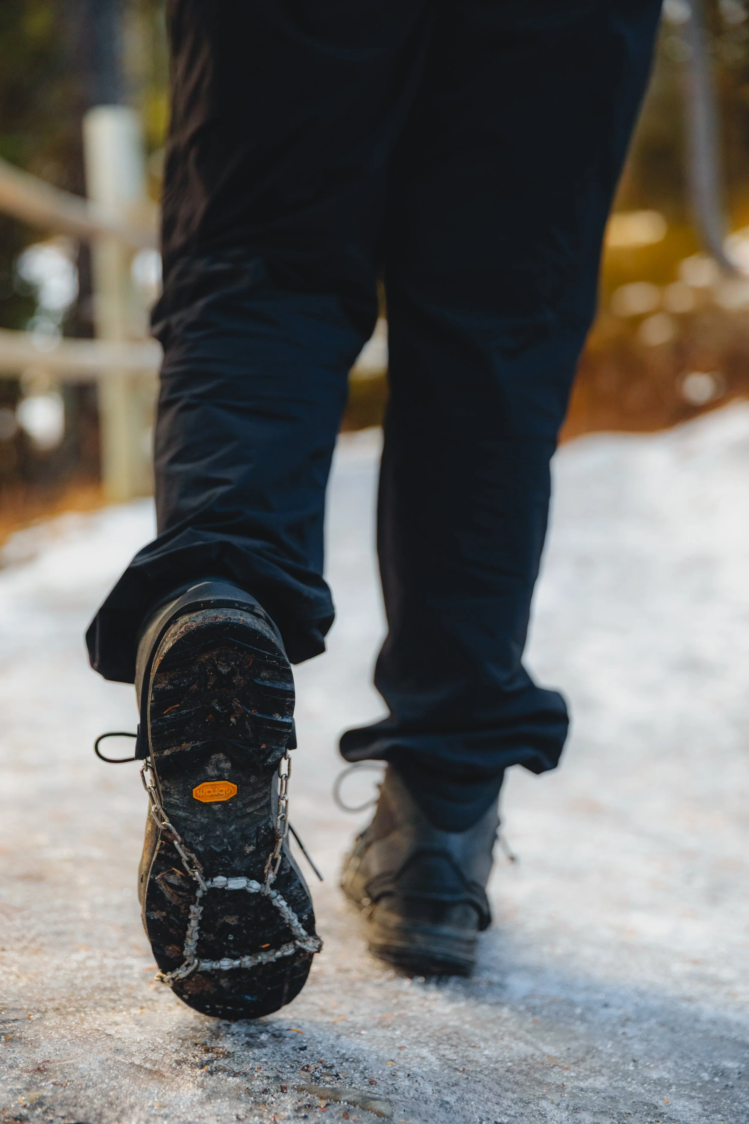
Microspikes, always! Simply keep them in your bag from late September, or at minimum, in your car.
That morning on the trail, I helped three different groups across an icy section because they couldn't move without slipping. I saw even more people slip and move very cautiously through sections, which looked way less fun. All of these folks had same thing in common: none of them had traction.
For 200 to 400g of weight you get traction that turns a sketchy descent into a normal one. I've keep them in my pack for every outing from September through late spring. There have been so many days even I’ve been caught surprised to see ice in sections, despite checking reports and weather. Sometimes I even bring extra pairs when I’m out with a group because ice can so easily turn a really enjoyable trail into frustrating, slippery discomfort. We’ve all been there!
Hiking poles. Did you know that hiking polesreduce the impact on your lower body joints by ~25%? In my 20’s I was all, “I don’t need poles, I’m strong and have good balance”. I wish my knees now could speak to 20 year old Alex. Not only are they great for your joints but of course on icy descents they're often what keeps a slip from becoming a fall. The trails closest to Canmore like Policeman's Creek Boardwalk, Benchlands Loop, and the Bow River Trail tend to stay forgiving longer into the season. But in any situation where you're gaining elevation or moving into shadier terrain, the ground shifts fast.
Beyond traction: I always suggest bringing an extra insulative layer, a hat, warm gloves, and a waterproof / windproof shell. Standing still at a summit or ridgeline drops your temperature faster than moving did especially after getting sweaty on the ascent. Another thing I never leave without: a headlamp with fresh batteries. Daylight shortens quickly in October and November and it's easy to lose track of time on a good day. And of course extra snacks, because cold temperatures burn energy faster than you'd expect and being the person who pulls out backup food an hour from the trailhead is a reliable way to make friends.
How to explore without a car
I'll be honest: I drove to almost everything my first few trips to the Banff and Canmore area. Parked in whatever lot was closest, circled for twenty minutes on a busy weekend to get frustrated and maybe eventually find a spot. I hadn’t learned that there were much better and sustainable options.
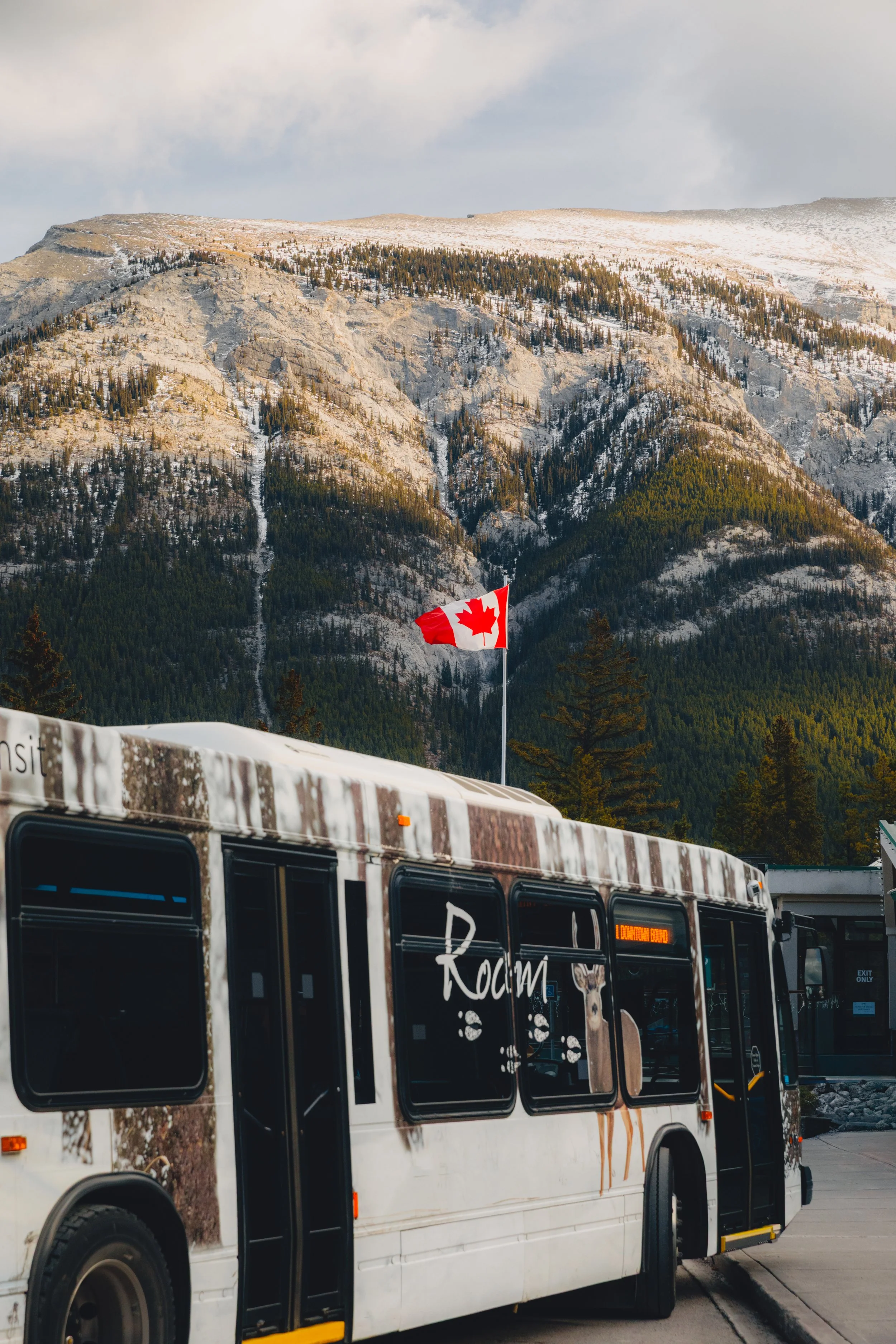
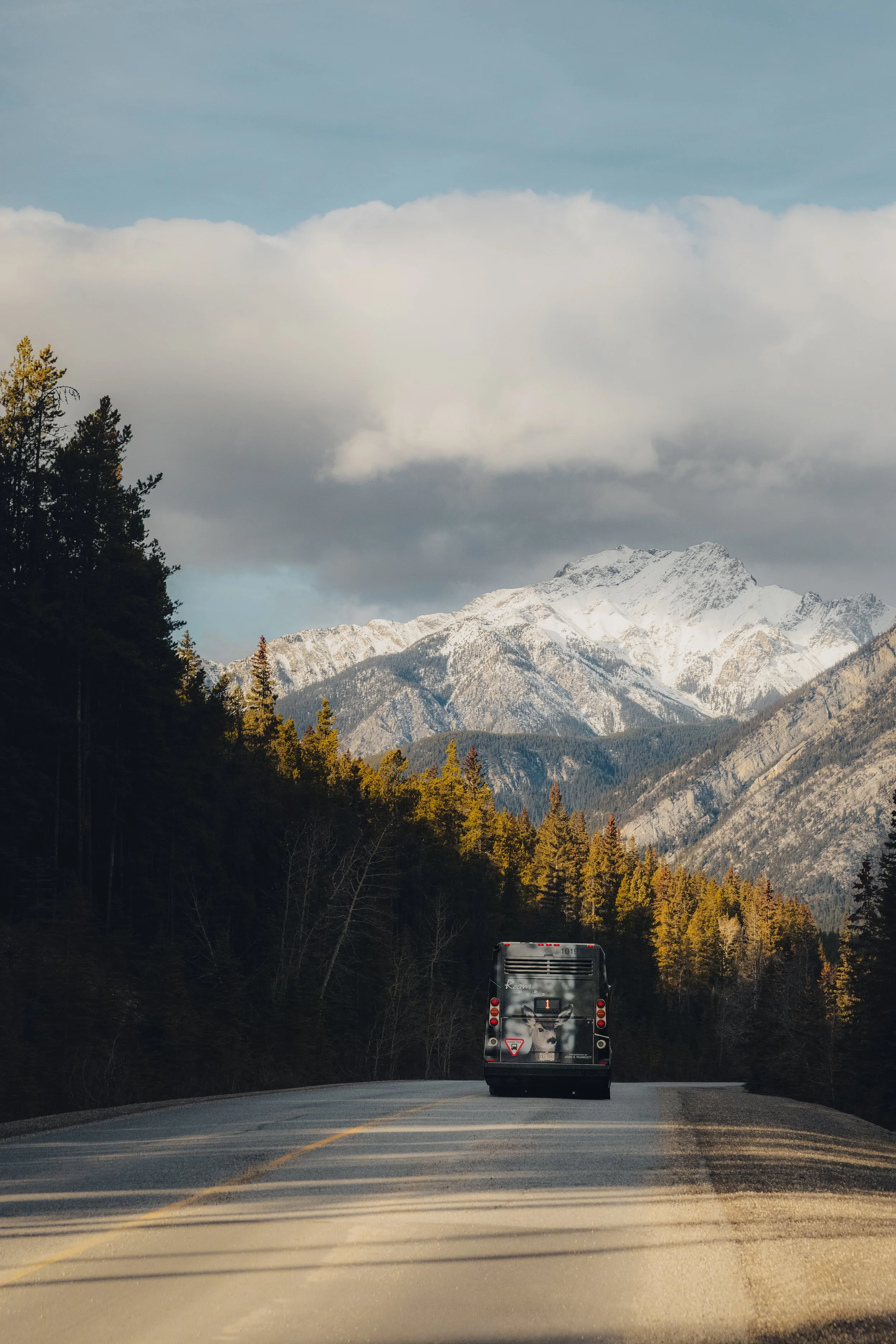
And man I really wish I’d know more about Roam Transit at the time!
Roam runs year-round connecting Canmore, Banff, and Lake Louise on a fleet of hybrid buses. I knew it existed, but I didn't realize that rides within Canmore are completely free and that the network actually reaches well beyond Canmore. From Canmore you can catch Routes 5C and 12 for local stops, plus the Canmore-Banff Regional Route 3 which connects to the Banff High School Transit Hub. From there: Route 1 to Sulphur Mountain and the Banff Gondola, Route 2 to Tunnel Mountain, Route 9 to Johnston Canyon on weekends, and the 8X Lake Louise Express. A single adult ticket to Banff is $6, and a system-wide day pass is $30.
Let’s circle back to the Coast Canmore Hotel because it’s right at the intersection of several of these routes. This genuinely makes the Coast one of the best-positioned home bases in the valley for getting around without a car for every single outing. On busy fall weekends especially, skipping the drive and the parking scramble is its own kind of low-impact win.
If you want to take a more “active” approach, the Rocky Mountain Legacy Trail is a 27 km paved route between Canmore and Banff built for bikes and e-bikes, with gentle elevation throughout. Pedego Electric Bikes and Rundle Bikes both offer rentals and are easily reached from the hotel on foot or bus.

Treading lightly when it matters most
I think there’s something about shoulder season that makes people feel like the “pressure” is off. Fewer crowds, no heat advisories, less people watching. It's actually quite the opposite.
Fall is one of the most sensitive times of year for trail surfaces and the surrounding ecosystem. The same freeze-thaw cycles that make terrain unpredictable are doing real work on the lichen, riverside vegetation, and fragile soil crusts as well. T
I started noticing this more over the last few years. You see the same sections of trail degrade over a season, see shortcuts get wider every weekend. None of it is malicious. Most people just don't know.
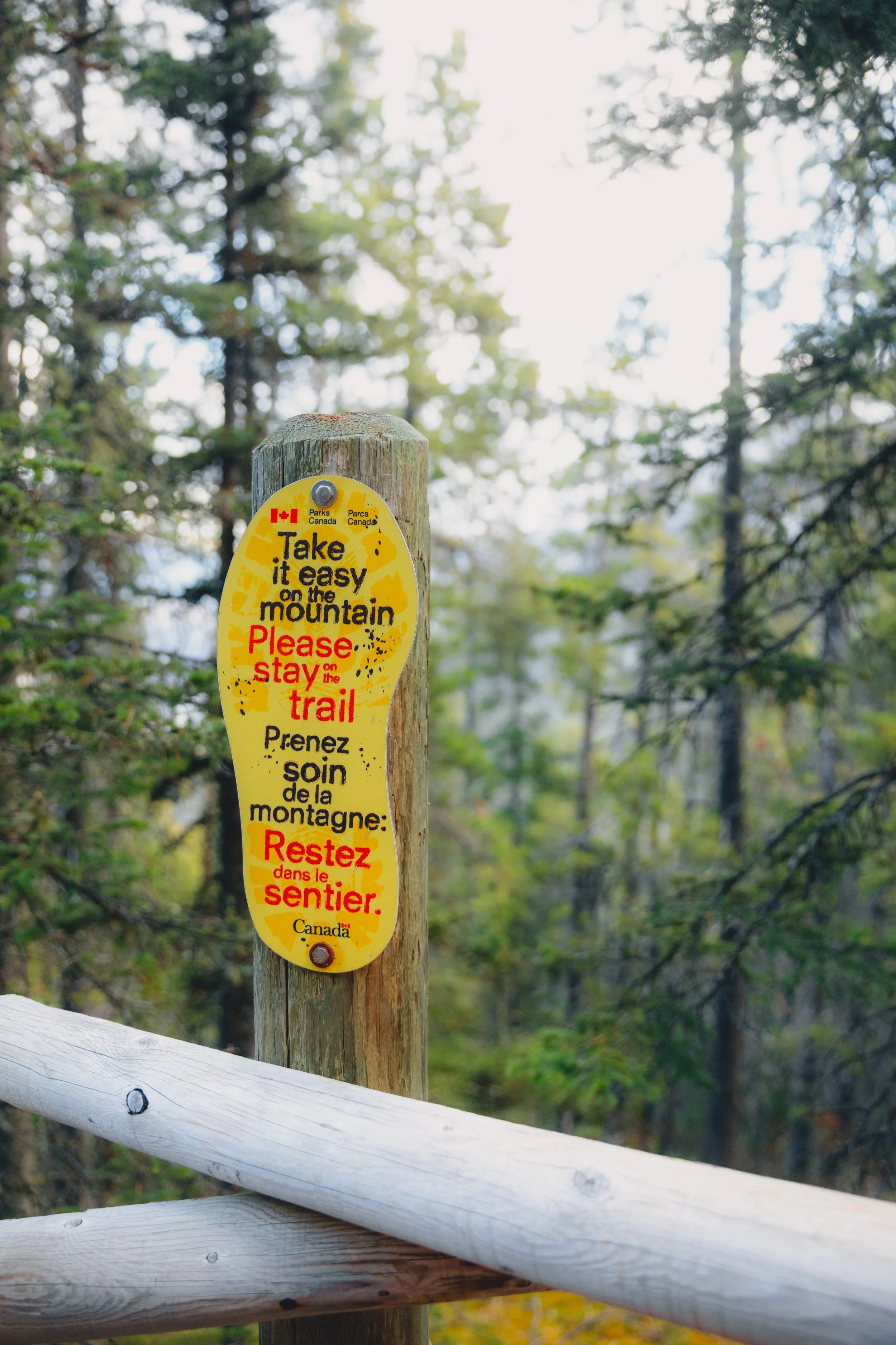
So my recommendations: stay on established trails, boardwalks, and packed surfaces. As always, pack out everything you packed in. Animals are shifting into winter patterns right now, surfaces are in flux, and the margin for casual impact is smaller than it looks.
Wildlife this time of year
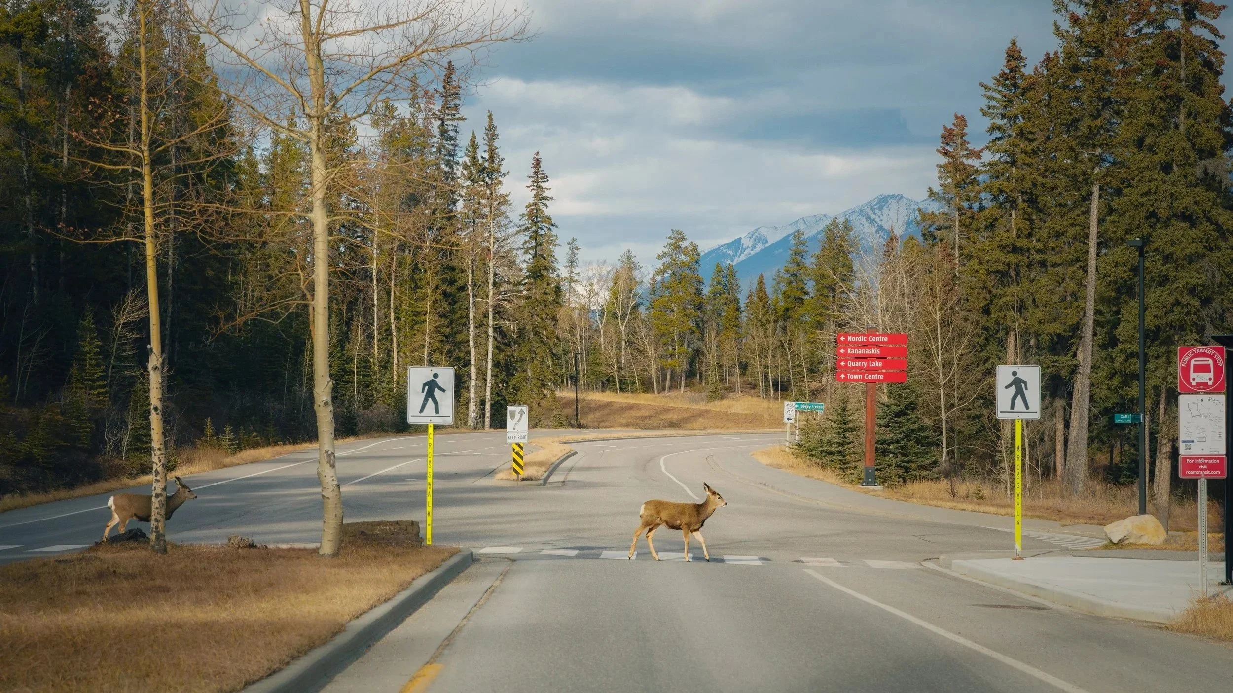
Speaking of animals, it’s also easy to assume that the wildlife are also quieting down this time of year.
However, bears are still active in shoulder season and often feeding aggressively in preparation for denning. In fact, this is one of the higher-risk windows for bear encounters on popular trails. Elk are in or just past rut, which means bulls can be unpredictable and in places they don't normally turn up. Wolves and coyotes are more visible as prey animals move to lower elevations.
To be clear, none of this is a reason to stay home, it’s simply a reason to stay attentive and maintain your distance: 30-metre minimum for elk, deer, sheep, and moose and 100-metre minimum for bears, wolves, and cougars apply regardless of season. If an animal changes its behaviour because of you, you're already too close. Remember to carry bear spray somewhere you can actually reach it, not buried at the bottom of your pack. I highly recommend checking the Biosphere Institute as they provide updated wildlife activity reports for the Bow Valley, great resource.
You’re all set to explore like a local
It’s way more fun being the person who checks the trail report the night before, has microspikes in their bag, hops the free bus from Canmore to the trailhead, and appreciates the elk from a healthy distance.
October and November in the Rockies are genuinely stunning and so worth a visit (I mean, they’re always worth a visit!). Quieter trails, first snow on the peaks, and the kind of stillness that doesn't exist in July. The variables are real but they're manageable, and once you've moved through this terrain a few times when the season is shifting, you start to understand why some people think it's the best time of year to be out here.
Questions about specific routes or conditions this time of year? Ask away in the comments or find me on Instagram.
These trails sit within Treaty 7 territory, the traditional lands of the Blackfoot Confederacy (Siksika, Piikani, and Kainai Nations), the Tsuut'ina Nation, and the Stoney Nakoda First Nation, as well as Métis Nation of Alberta, Region 3.
Alex Mack is a landscape and adventure photographer, ACMG apprentice hiking guide, and high altitude physiologist based in Vancouver, BC. She writes about mountains, photography, and the space where science meets adventure.
With appreciation that the lands known today as Canada are home to the enduring presence of all First Nations, Métis, and Inuit peoples. We acknowledge the past, present, and future generations of these Nations who continue to lead us in stewarding this land, and honour their knowledge and cultural ties to this place.